
Shelsley Kings
Quick Links
Location
O.S. Ref: SO726650
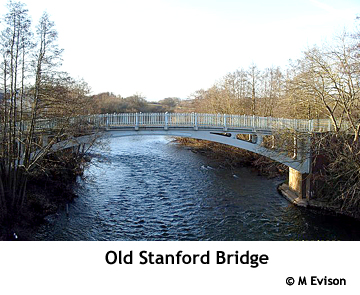
North of Shelsley Beauchamp, east of the river Teme, south of the B4203 with Kingswood Common and The Grange on its eastern boundary. Includes Stanford Bridge in its northwest corner.
Census Records
All the censuses between 1841 and 1901 are now available on a number of fee-paying (Subscription or PayAsYouGo) sites including Ancestry.co.uk, FindMyPast.co.uk, thegenealogist.co.uk and genesreunited.co.uk. The 1911 census is available in full or in part on some of these sites. We are unable to advise on the choice of site since researchers' personal preferences will be influenced by the content and search facilities offered by each site. Some sites offer a free trial.
Access to the library edition of Ancestry.co.uk is widely available at most record offices, including Worcestershire Archives, and some libraries. You are advised to book time on their computers before making a visit.
A free-to-view site is being developed at freecen.org.uk for the 1841, 1851, 1861, 1871 and 1891 censuses. Coverage of Worcestershire parishes is rather sparse at this time.
Census returns can usually be viewed at Church of Jesus Christ of Latter Day Saints' Family History Centres.
Some repositories offer census details on microform, disc or printed copy. These include:
1841-1901 at Worcestershire Archives [14]
Directories
An extract from the Topographical Dictionary of England 1831 by Samuel Lewis:
SHELSLEY (KING'S), a hamlet in that part of the parish of SHELSLEY-BEAUCHAMP which is in the upper division of the hundred of DODDINGTREE, county of WORCESTER, 9½ miles (S. W. by W.) from Stourport, containing 264 inhabitants.
Last Updated: 21/07/2012